The Devonshire Collections preserved at Chatsworth by the Chatsworth House Trust charity, contain one of the largest estate archives still housed and maintained by an estate.
In broad terms, the archive covers two main areas: family and estate papers, both covering hundreds of years. The family papers include thousands of personal letters, diaries, accounts, scrapbooks and photographs relating to the Dukes and Duchesses of Devonshire, associated members of the Devonshire family and their acquaintances.
The estate papers cover the whole business of estate management and include correspondence, rental ledgers, property deeds and maps, relating to the Devonshire estates in Derbyshire, Yorkshire, Sussex and Ireland.
A recent project by Chatsworth's GIS Team (Geographical Information Systems) to digitise a 1922 map of Buxton has led to the two departments working together to bring historical maps from the archive to life, revealing how different locations across the Derbyshire Peak District have evolved over the centuries.
What is GIS?
Lots of definitions for Geographic Information Systems, or GIS, exist but a simple way to think of it is a system for recording and visualising information geographically i.e. on a map, which enables us to see patterns, relationships, and trends. GIS systems become more powerful as you increase a map's number of datasets or ‘information layers’.
The Chatsworth GIS Team is still a fairly young team and primarily focused on helping the Derbyshire Land Agents manage the Derbyshire Estates, maintaining a detailed database of how the land is subdivided between tenants and producing lots of maps, or plans.
Before GIS technology existed, the team used to annotate and colour code standard Ordnance Survey maps, a very laborious process. Many of these older maps are still used today to understand the history of a plot of land and the estate's legal position relating to it, e.g. a piece of land may have been sold with a 'restrictive covenant' which limits what future owners can do with it, offering a layer of protection to the national park environment.
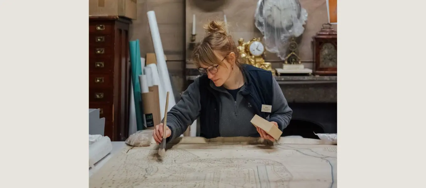
Image above: The charity's collections team undertake the preventative conservation of maps in the archives
Following the successful digitisation of the Buxton map, the teams decided to bring other historical maps held in the archives to life.
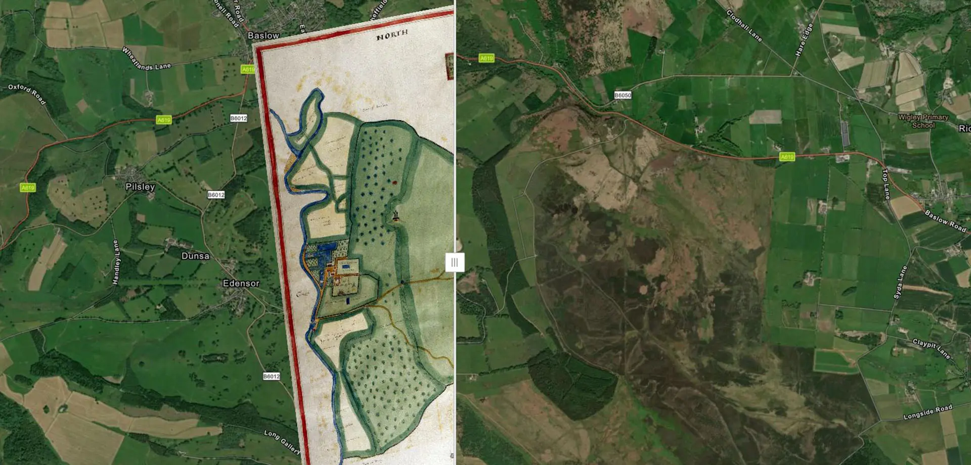
Two particularly interesting maps were selected: a 1617 map of Chatsworth Park by surveyor William Senior, the earliest map of Chatsworth in the collection, and a 1785 map of Edensor.
For the GIS team, the goal was to ‘georeference’ the maps so that they can become new data layers within Chatsworth's GIS system. For the archive team, it presented the opportunity to aid the many researchers who utilise Chatsworth's archives for their own work.
The Chatsworth Archive
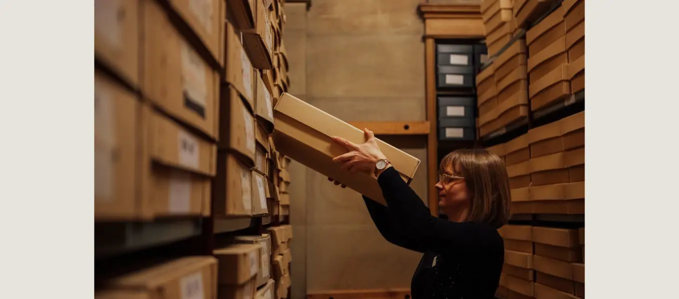
The map collection, preserved in the archives by the Chatsworth House Trust charity, is popular with researchers and contains hundreds of maps dating from the 17th-20th centuries. These maps not only provide details of land and property ownership, they can also be used to show how areas of land have evolved over time.
When looking at a historic map, it can be difficult to situate yourself within the current landscape. Through the work of the GIS team, these historical documents can be brought to life.
The earliest map of Chatsworth in the archive
As the earliest map of Chatsworth within the collection, dated 1617, the teams were keen to see how this map looked in the GIS System.
This map forms part of a series of maps called 'the Chatsworth Atlas' by William Senior that document the estates of the 1st Earl of Devonshire in the early 17th century.
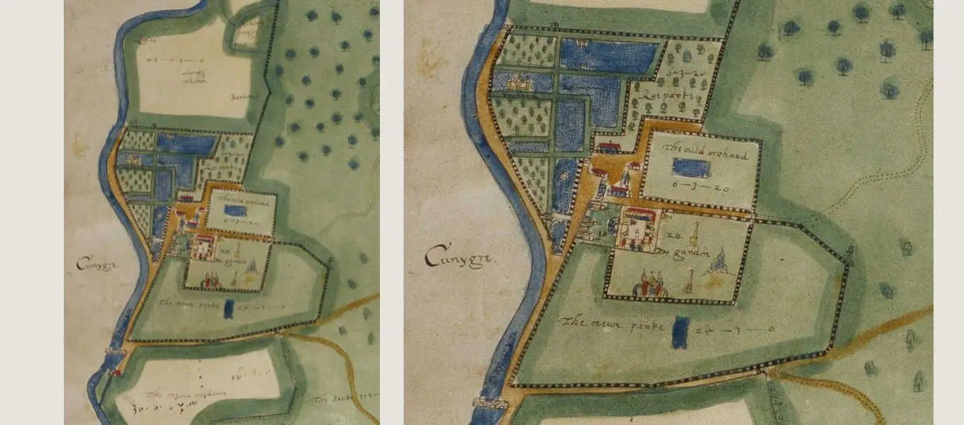
The maps, with the accompanying survey of the Earl’s tenants, provide an amazing snapshot of land use at that period. You can see the original house, built by Bess of Hardwick, the formal gardens, and the production garden that would have provided food for the estate.
Once layered in the GIS system, what stands out about this map is its remarkable accuracy. Notably, the locations of Park Gate Farm to the north and Park Farm to the south are accurate to within a metre, a testament to Senior's meticulous work.
The georeferenced map has also provided insights into ongoing archaeological work. Chatsworth’s archaeological consultant used the map alongside GPS technology to verify and date architectural structures revealed as part of the Masterplan.
The 1785 Map of Edensor
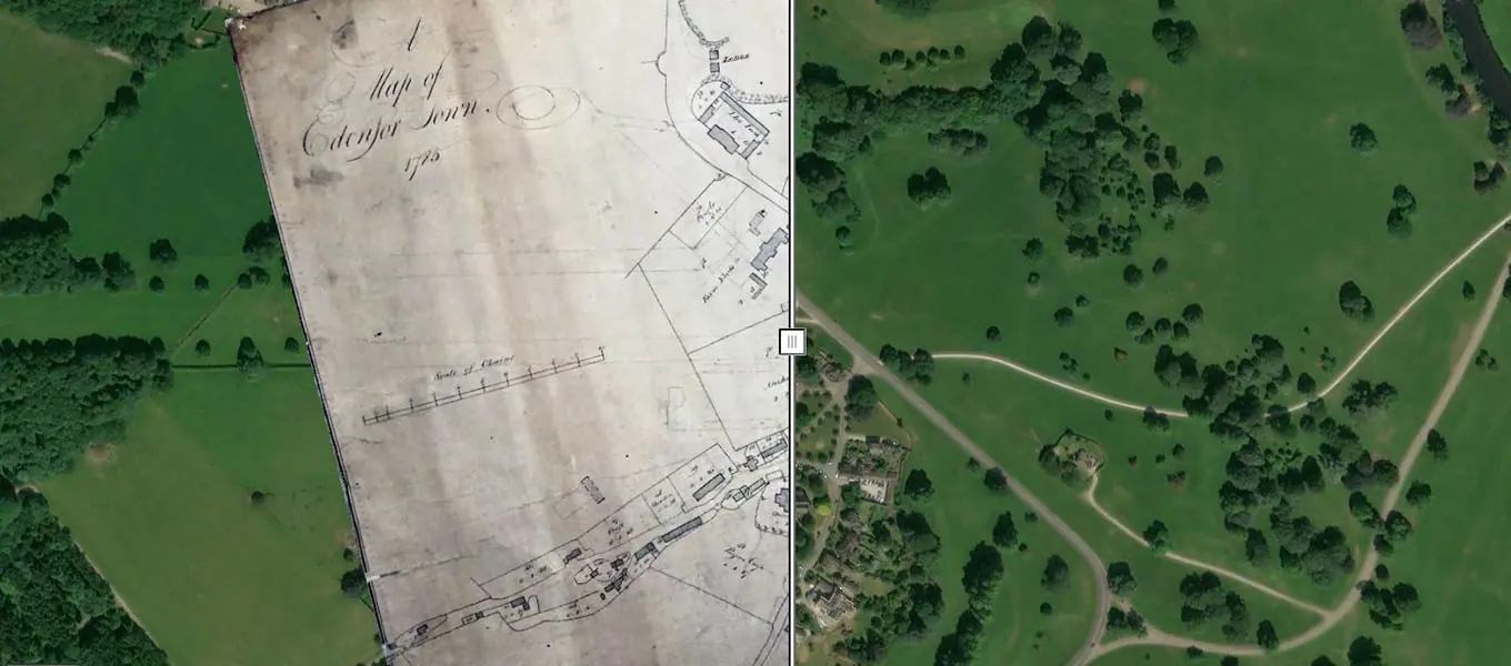
The 1785 map of Edensor (above) shows a village that is very different to the one we see today. While properties in modern day Edensor boast a wide variety of architectural styles in one main area, the Edensor shown in 1785 shows buildings spread out along a former main route to Chatsworth, straddling flat ground to the west of the house as far as the river.
The new arrangement sees the majority of cottages clustered around the 14th century St Peter's Church and accessed through gate and cattle grid within a retaining wall, and is the result of a major redevelopment in the 19th century by the 6th Duke of Devonshire and Joseph Paxton. It's believed that the Duke and Paxton dug out pattern books and selected their favourite styles of architecture, with draughtsman John Robertson given the task of transforming the pictures into stone. Read more about Edensor here.
In her book ' The Estate: A View of Chatsworth', Duchess Deborah Devonshire dismisses the popular notion that the cottages were knocked down by the 6th Duke because they spoiled his view, saying this it is 'unproven...out of character with the 6th Duke who liked his fellow men...and because the lie of the land meant that only two or three house could be seen'. A more probable reason for the redevelopment, in the Duchess's opinion, was in order to accommodate a new road to the house and to create open parkland while avoiding the need to individually fence each house's boundary.
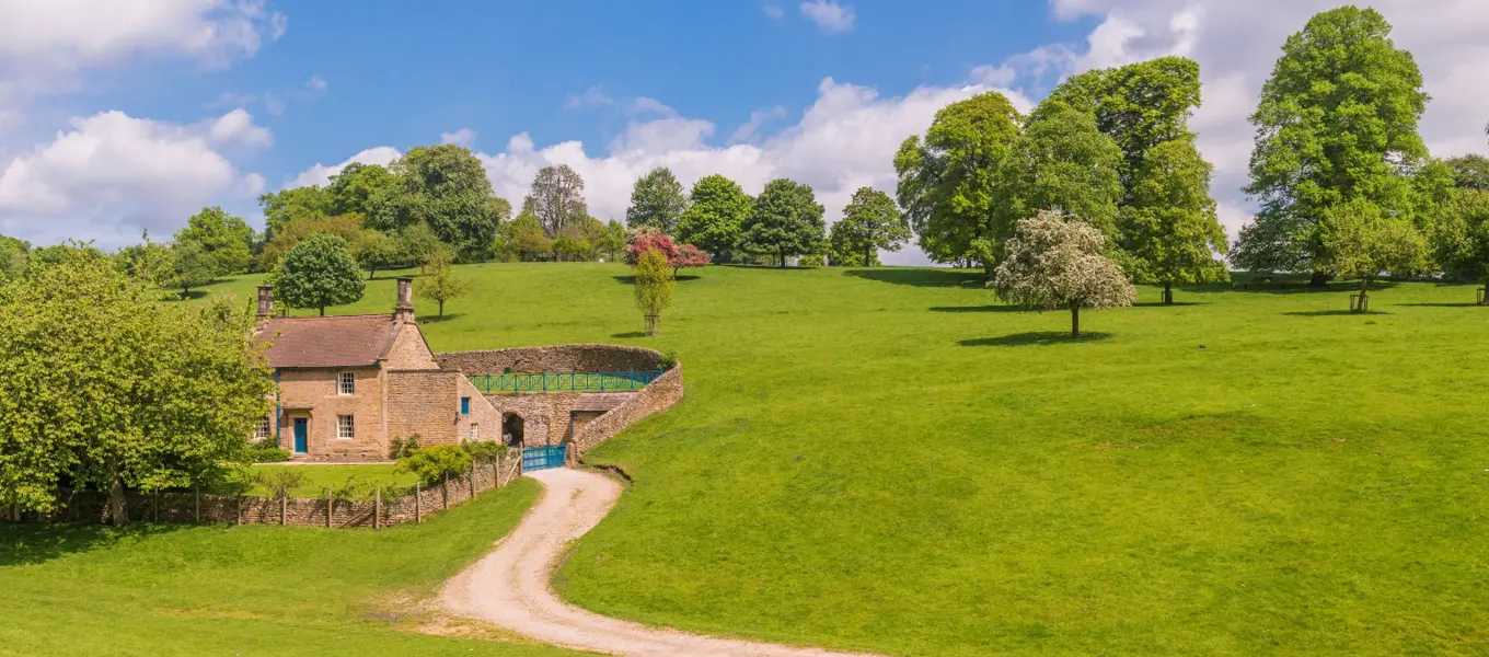
One house was spared, now an estate holiday let called Gardener's Cottage (below) and visible on the left of the village as you head towards Chatsworth. It can be seen on both the 1785 and modern-day maps and provides a useful anchor for comparing the two. There are several theories as to why it may have been retained, some believe it was occupied by an elderly gentleman, Thomas Holmes, who the 6th Duke did not wish to disturb and others think it possible that the tenants refused to move, however, recent research into letters between the 6th Duke and his land agent at the time, Sydney Smithers, suggests it was prompted by a drive to reduce expenditure. Read more here.
Before digitisation, when looking at the 1785 map it was hard to visualise where the original buildings would sit in today’s landscape. Using GIS helps to transform our understanding of this document, and how the village of Edensor was changed by the 6th Duke and Paxton.
About Chatsworth House Trust
Chatsworth House Trust is a registered charity established in 1981 to care for and improve the house, collection, garden and parkland for the continued enjoyment of everyone.
All income from ticket sales, Gift Aid, donations, legacies, sponsorship, and our membership schemes goes directly to the charity to be reinvested in an ever-expanding programme of essential conservation, in exhibitions, our learning and community programme, and in creating opportunities for Chatsworth's archives, art and artefacts to be studied, seen and enjoyed by people the world over.
If you would like to make a donation to support our work, you can do so online here:
Alternatively, why not consider becoming a Chatsworth Friend or Patron and experience the benefits of unlimited visits, exclusive events and experiences, discounts and complimentary tickets to the country fair and Christmas at Chatsworth.
About Chatsworth House Trust
Chatsworth House Trust is a registered charity established in 1981 to improve and maintain the house, collections, garden, woodlands and park for the benefit of everyone.
Support our Cascade Campaign
The Cascade has been delighting visitors to Chatsworth since 1696 but is now in need of urgent repair. Learn more about our fundraising campaign 'Celebrating the Cascade'.
Donate online
If you can, support us by making a one-off or regular donation to the Chatsworth House Trust charity online.
Chatsworth Friends
Support the work of the charity while benefitting from unlimited visits, free tickets to events and discounts on shopping, dining and stays.
Gift Aid
When you use Gift Aid, the government gives an extra 25% on top of your kind donation, in lieu of tax you have already paid. All of this money goes directly to Chatsworth House Trust.
Patrons of Chatsworth
Patrons play a vital role in supporting the long-term stewardship of Chatsworth and enjoy exclusive access to the collections and curatorial team via special events.


